The app stores are full of hiking apps promising to transform your mountain experience. Most of them have impressive feature lists. But standing on a wet ridge in the Cairngorms at 1,000 metres, with cold fingers and fading light, you realise very quickly which features matter and which ones are just marketing. This guide cuts through the feature lists and tells you what to actually look for in a Munro bagging app.
Non-Negotiable: Offline Maps
This is the feature that matters most, full stop. Mobile signal in the Scottish Highlands is unreliable at best. On many popular Munros — including sections of the Cairngorms, most of Angus Glens, and huge swathes of the north-west Highlands — there is simply no signal at any point on the route. An app that requires connectivity to show you the map is an app that fails at the exact moment you need it most.
Good offline map support means you can download the relevant map tiles at home on WiFi, then navigate all day in the mountains without any signal required. Before choosing any Munro app, test this specifically: download a map area, turn your phone to aeroplane mode, and see whether the app still works. If it does not, keep looking.
Essential: Summit Log and Progress Tracking
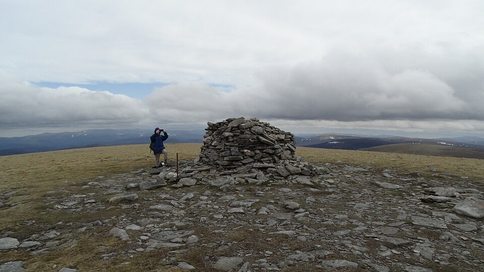
The defining feature of a Munro bagging experience — versus general hillwalking — is working towards a completion of the full 282-peak list. A good Munro tracking app should have all 282 Munros pre-loaded with a completion status you can update as you summit each one. It should show you how many you have done, what percentage of the list that represents, and which mountains remain.
Regional breakdowns are particularly useful for trip planning: being able to see that you have done ten of the seventeen Perthshire Munros but only two of the Torridon peaks tells you exactly where to focus your next few trips. Look for a completion tracker that gives you this kind of granular regional view, not just a single overall count.
Very Useful: Mountain Weather Integration
Mountain weather in Scotland is notoriously unpredictable and changes faster than lowland forecasts suggest. A good Munro app should integrate weather data specific to the summit elevation — not just the nearest town's forecast, which can be dramatically different from conditions at 1,000 metres. Mountain-specific forecasting takes into account the summit temperature, wind speed and direction at altitude, visibility, and precipitation probability for the specific mountain you are planning to climb.
This feature does not need to be built into the app itself — many people use a separate mountain weather service alongside their tracking app — but having it integrated saves time and reduces the risk of planning a trip based on a town forecast that has no bearing on summit conditions.
Useful: GPS Route Recording
Recording your route as you walk creates a permanent record of how you actually climbed each mountain — useful for repeating good routes, sharing with others, and comparing against planned routes. GPS tracks also provide useful safety information: if something goes wrong, a rescuer can see exactly where you were and when.
For this feature, battery management matters. GPS recording is power-hungry, and a full day on the hills can drain a phone battery significantly. Look for apps that offer a background tracking mode that balances accuracy against power consumption. Carrying a power bank on longer days is wise regardless of which app you use.
Useful: Route Information for Each Munro
Pre-loaded route information — approach notes, typical ascent time, difficulty rating, grid reference for the car park or start point — saves significant planning time. For a list of 282 mountains, many of which you will be approaching for the first time, having this information in your tracking app means you do not need to research each mountain separately across multiple sources.
The quality of this information varies significantly between apps. Look for apps where the route notes are written by people who have actually climbed the mountains, rather than algorithmically generated summaries. For specific Munros, check whether the notes reflect the actual experience: does the difficulty rating match what other walkers report? Are there notes on seasonal variations — cornice risk in winter, river crossing levels in spring?
Nice to Have: Social Features
Some Munro apps include social features — following other Munroists, sharing summits, seeing what mountains friends have recently climbed. For motivation and community, these features can be valuable, particularly for solo Munroists who want a sense of shared endeavour. But they are firmly in the "nice to have" rather than "essential" category.
Do not trade essential features (offline maps, reliable summit tracking) for social features. An app that works perfectly in the mountains but has no community features is significantly better than an app with a great social layer that loses your map when signal drops.
What to Ignore
Some features are heavily marketed but of limited practical value in the Scottish mountains:
- 3D terrain views: visually impressive, practically irrelevant when navigating in cloud
- Augmented reality overlays: drain battery, require signal, rarely work in poor visibility when you most need them
- Integration with fitness trackers: useful for personal records but not for actual mountain navigation
- Large trail databases: impressive numbers, but 280 unknown trails in Colorado are worth less than accurate data on the specific 282 Munros you are actually climbing
The Practical Verdict
For a dedicated Munro bagger, the ideal app has offline maps, a complete 282-Munro database with summit logging, mountain weather, and GPS tracking. Everything else is secondary. Munros App is built around exactly these priorities — the features that matter in the mountains, without the clutter that sounds good in a marketing brochure but adds nothing when you are navigating in the cloud.
Before any big Munro day, run through this quick checklist: map downloaded for offline use, route information reviewed, weather checked for summit elevation (not just the nearest town), phone charged and power bank packed. The best Munro app in the world cannot replace preparation — but it can make that preparation significantly faster and more reliable.
Related guides
- Best Munro bagging apps in 2026 — full comparison for iPhone and Android
- How to track your Munro progress — comparing apps, spreadsheets, and paper lists
- Munros tracking app — purpose-built for Scotland's 282 peaks
Browse Related Hubs
Track your Munros
Log summits, get summit weather, and follow GPS routes for all 282 Munros. Free on the App Store.
Download the Free App