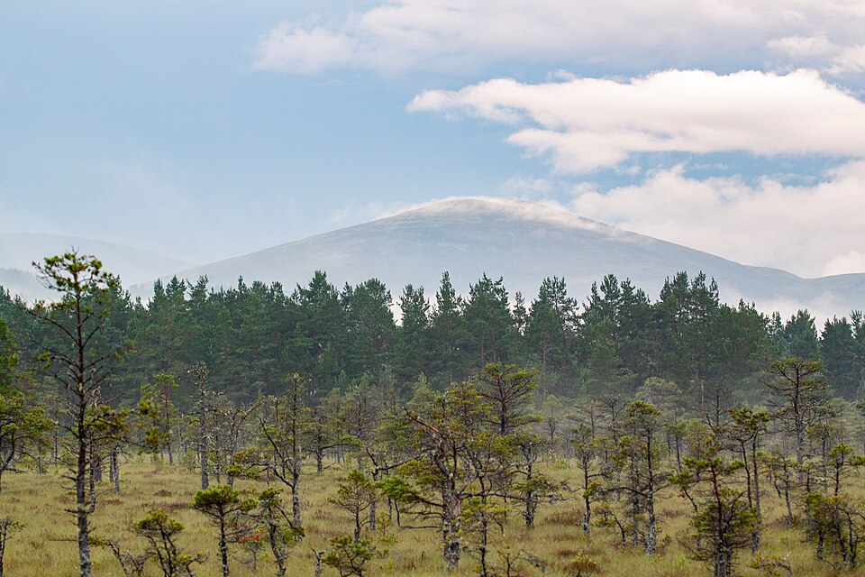
Cairn Gorm is the sixth-highest Munro in Scotland at 1,245 metres, and the hill that lends its Gaelic name — An Càrn Gorm, the "blue cairn" — to the entire range. Rising above Aviemore and Glenmore in the heart of the Cairngorms, it is one of the most accessible high Munros in the country thanks to the ski road that climbs most of the way up its northern flank. That easy access is exactly why it needs to be treated with respect: the ground above the summit is genuinely arctic.
The standard ascent from Coire Cas
Almost everyone starts from the Coire Cas car park at the Cairngorm Mountain ski centre, at the very end of the ski road up from Glenmore. From there the most direct line climbs the broad northern shoulder — either up the Fiacaill a' Choire Chais or the well-trodden path alongside the ski area — to the summit and its weather station. It is a comparatively short but steep pull onto the top, and on a clear day it can be done in a few hours there and back. The Munros app lists the fuller walking routes and their exact distances, with the car park pinned and the forecast stored offline for the day.
The Northern Corries: the finer approach
For a more mountainous day, the Northern Corries — Coire an t-Sneachda and Coire an Lochain — give a far grander approach, climbing between crags that are among Scotland's best-known winter climbing grounds before gaining the plateau rim. It is rougher, wilder and quieter than the ski-side path, and turns Cairn Gorm from a quick tick into a proper hill day. In winter these corries are serious mountaineering terrain and avalanche-prone; save them for summer unless you have full winter skills.
Onto the plateau — and the real seriousness
What makes Cairn Gorm special, and dangerous, is what lies beyond the summit. Step south and you are on the edge of the Cairngorm plateau, the largest area of high ground in Britain — a featureless, sub-arctic expanse where the weather can turn ferocious with little warning. Navigation up here is genuinely committing in cloud, and this is ground where experienced parties have come to grief. Strong walkers cross the plateau to Ben Macdui, Britain's second-highest mountain — a magnificent expedition covered in our guide to how to climb Ben Macdui, but one that demands solid map-and-compass skills and a careful eye on the mountain forecast.
When to go and what to pack
Cairn Gorm is a rewarding walk from late spring through autumn. In winter the whole massif becomes a full snow-and-ice environment — this is the coldest, snowiest ground in Britain — and should only be attempted with the kit and experience a winter round demands. In any season, carry proper layers, waterproofs, hat and gloves even in summer, a headtorch, and a map and compass you can actually use. The summit is routinely twenty degrees colder and far windier than the car park below.
Related guides
- How to climb Ben Macdui — the plateau crossing to Britain's second summit
- Munro bagging in the Cairngorms — the wider range
- Cairngorms Munros — every peak in the region
Munros in this article
Browse Related Hubs
Track your Munros
Log summits, get summit weather, and follow GPS routes for all 282 Munros. Free on the App Store.
Download the Free App