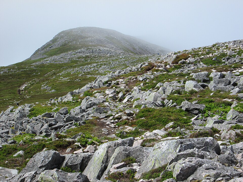
Schiehallion is one of the most recognisable mountains in Scotland — an isolated 1,083-metre cone rising between Loch Rannoch and Loch Tummel in highland Perthshire. Its name means the Fairy Hill of the Caledonians, and its near-perfect symmetry has made it both a favourite first Munro and a genuine landmark in the history of science. It is a straightforward hill by Munro standards, but the upper mountain has a sting that surprises a lot of walkers.
The route from Braes of Foss
There is one standard route, and it is a good one. It starts from the Braes of Foss car park on the mountain's north-east side and climbs the long east ridge to the summit. The round trip is about 10 kilometres with 760 metres of ascent, taking most walkers 4 to 5.5 hours. The lower path, rebuilt by the John Muir Trust to repair years of erosion, is excellent and easy to follow across open moor and up onto the broad ridge.
The boulderfield that catches people out
The sting is in the tail. Above roughly 900 metres the constructed path fades and the ridge becomes a wide, tilted field of quartzite boulders that runs all the way to the summit. It is slow, ankle-twisting going, and there are several false summits — the true top is always a little further than it looks. In clear weather it is simply tiring; in mist it is genuinely disorientating, because the boulders hide any trodden line and the ridge is broad enough to lose your bearings. Take your time, watch your footing, and be confident with a map and compass before committing to the top in poor visibility.
The mountain that weighed the Earth
Schiehallion has a remarkable claim to fame. In 1774 the astronomer Nevil Maskelyne chose it for a famous experiment to estimate the density — and therefore the mass — of the Earth, by measuring how much the mountain's gravity deflected a pendulum. The hill was ideal because of its regular, isolated shape. To calculate its volume, the surveyor Charles Hutton grouped measurements of equal height into lines — and in doing so effectively invented the contour line that appears on every map you carry today. It is a genuinely nice thing to think about on the summit.
When to go and what to expect
Schiehallion is a fine walk from spring to autumn, and its accessibility and moderate length make it popular as a first or second Munro. In winter the boulderfield fills with snow and becomes a proper mountaineering proposition with cornice and navigation hazards — treat it accordingly. Whatever the season, carry warm layers, waterproofs, food and water, and check the summit forecast. There are no facilities on the hill, though the car park has parking charges that support the path maintenance.
A rewarding summit
From the top, the reward is a huge Perthshire panorama — Loch Rannoch stretching west toward Rannoch Moor, Loch Tummel to the east, and a sea of hills in every direction. For a mountain this accessible, it is an outstanding viewpoint. Record the climb in the Munros app, which stores the offline map and route for the featureless upper section where a phone map is genuinely useful, and adds Schiehallion to your running tally of the 282.
Related guides
- Munro bagging in Perthshire — the wider region
- Navigation skills — for the summit boulderfield
- Best Munros for beginners — more accessible first hills
Munros in this article
Browse Related Hubs
Track your Munros
Log summits, get summit weather, and follow GPS routes for all 282 Munros. Free on the App Store.
Download the Free App