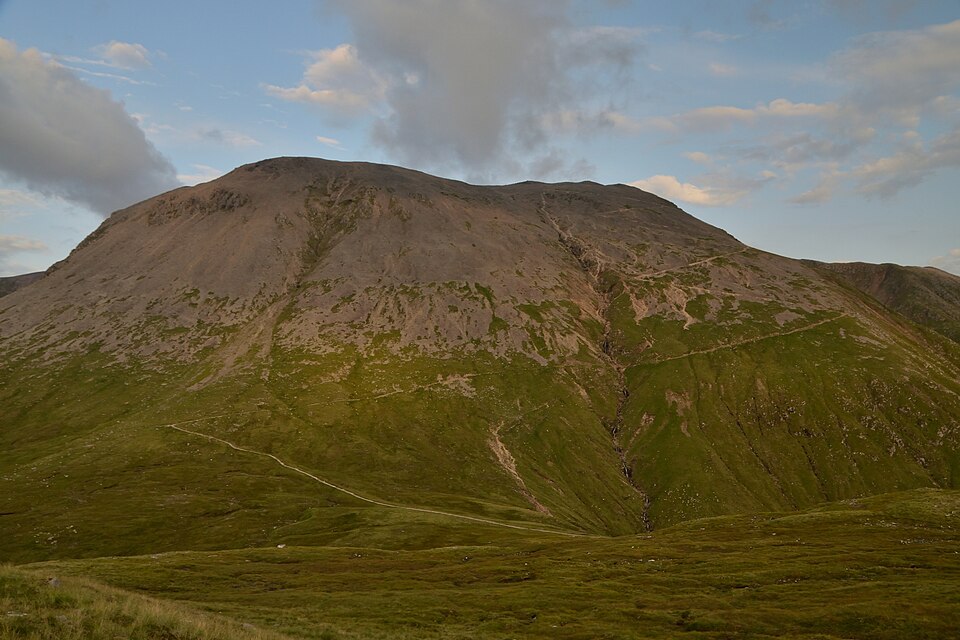
Ben Nevis is the highest mountain in Britain at 1,345 metres, and for many people it is the first or only Munro they will ever climb. That popularity is exactly why it deserves respect: more walkers get into difficulty on Ben Nevis than on any other Scottish hill, almost always because they underestimated it. Climb it prepared and it is one of the great days in the British mountains. Here is what you need to know.
The Mountain Track: the standard route
The overwhelming majority of walkers ascend by the Mountain Track (still widely called the Pony Track or Tourist Path), which starts at Glen Nevis near Fort William. It is a relentless, well-built zig-zagging path of around 17 kilometres round trip with 1,300 metres of ascent, and it takes most people 7 to 9 hours there and back. There is no scrambling, but there is no let-up either — it climbs almost continuously from the valley floor to the summit plateau.
Do not be fooled by the word "tourist". The path is clear and popular, but it crosses high, exposed mountain terrain that holds snow well into summer and is frequently in cloud. The danger is not the difficulty of the walking — it is the scale, the weather and the summit navigation.
The CMD Arête: the connoisseur's route
The far finer way up — for experienced hillwalkers only — is the Carn Mor Dearg Arête, which takes in the neighbouring Munro Carn Mor Dearg and crosses a narrow, rocky ridge to Ben Nevis with spectacular views of the mountain's huge north face. It is a long, committing day with genuine exposure and easy scrambling, unsuitable for beginners or for poor weather, but it transforms Ben Nevis from a slog into a classic. Treat it as a serious mountaineering route and pick a settled, clear day. The route also opens the door to a bigger round taking in Aonach Mor and Aonach Beag for the very fit.
The real hazard: the summit plateau
The most dangerous part of Ben Nevis is not the climb but the summit plateau in poor visibility. The top is a wide, featureless expanse rimmed by cliffs, and in cloud — which is the norm rather than the exception — it is genuinely easy to walk off the edge or descend into the wrong corrie. Two specific compass bearings are used to navigate safely off the summit, avoiding both Five Finger Gully and the cliffs of the north face. If you cannot confidently take and follow a bearing, do not climb Ben Nevis in cloud. Our guide to navigation skills covers exactly this kind of situation.
What to pack and when to go
Treat Ben Nevis as a full mountain day even in summer. Take warm layers, full waterproofs, plenty of food and water, a map and compass (and the skill to use them), a head torch, and a charged phone. The summit can be near freezing with gale-force wind while Fort William is warm and still. May to September is the realistic snow-free window for walkers; from autumn through spring the upper mountain is a winter mountaineering environment requiring an ice axe, crampons and the training to use them. Check the mountain forecast for the summit, not the town, and be willing to turn back.
A mountain worth doing properly
Ben Nevis rewards preparation and punishes complacency. Pick the right route for your experience, choose a good forecast, carry the kit, and know how to navigate off the top, and you will have earned one of the proudest entries in any Munro log. Record the day in the Munros app — with offline maps of the summit area and the route stored on your phone, you have the navigation backup that this particular mountain, more than any other, makes worthwhile.
Related guides
- Navigation skills for the Scottish mountains — the compass work the summit demands
- Munro bagging in Glen Coe and Ben Nevis — the wider region
- Fort William Munros — peaks around Britain's highest mountain
Munros in this article
Browse Related Hubs
Track your Munros
Log summits, get summit weather, and follow GPS routes for all 282 Munros. Free on the App Store.
Download the Free App