Home Features Explore Munros Munro Map Live Conditions Reviews Get the App
Beinn an Dòthaidh, Argyll, Scotland

Beinn an Dòthaidh

1,004m Argyll

“Mountain of Scorching”

12.4kmRound trip
4.3–5.6hWalk time
Moderate · 2/5Difficulty
Community summits
2Last 30 days
0Last 7 days
0Today
Live
Current conditions
13 days ago
DryUnderfoot
OpenAccess
QuietBusyness
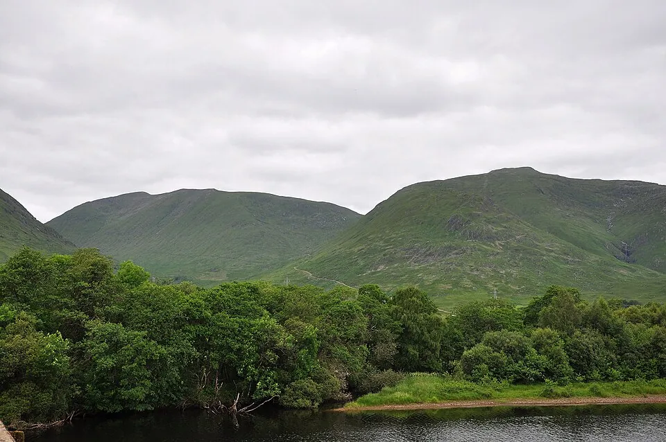
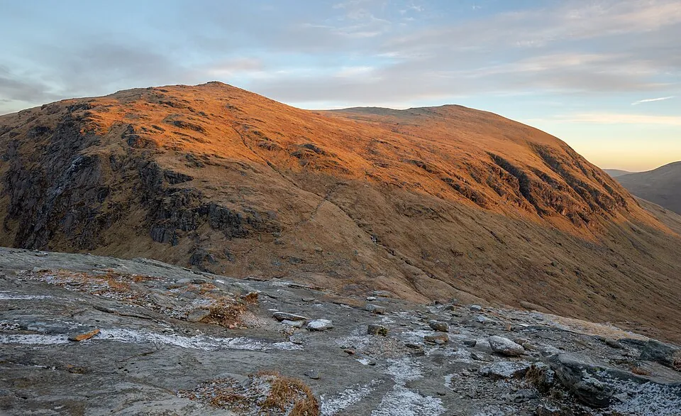
Photo: Podzemnik · CC BY-SA 4.0
Overview

About this Munro

Beinn an Dòthaidh is a 1,004m Munro in the Argyll region, its Gaelic name meaning “mountain of scorching”. It stands 133rd of the 282 Munros by height. The usual ascent — Beinn an Dòthaidh from Auch Glen — is a 12.4km round trip taking 4.3–5.6 hours, rated moderate (2/5).

Height rank133rd of 282
RegionArgyll
Coordinates56.5303°N 4.7127°W
OS Grid RefNN 332 408
GPS routes in the appSummit location — full route lines, parking pins & offline maps in the free app.
Plan your day

Routes & Navigation

There are 2 routes to the summit of Beinn an Dòthaidh, ranging from 12.4km.

Preview — full GPS track in the app

Beinn an Dòthaidh from Auch Glen

4.3–5.6h round trip12.4km distance
2 summits logged in the last 30 days
In the free appExact parking pin · step-by-step directions · offline GPS trackGet the app
Preview — full GPS track in the app

Beinn Dòrain and Beinn an Dòthaidh from Auch Glen

Bags 2 MunrosBeinn an DòthaidhBeinn Dòrain
4.8–6.2h round trip13.8km distance
2 summits logged in the last 30 days
In the free appExact parking pin · step-by-step directions · offline GPS trackGet the app
Summit forecasttemperature adjusted to 1,004m

Loading forecast…

Live from the hill

Community conditions

What walkers found up there recently — logged on the summit in the Munros app.

2 reports0 reports0 today
7+ days ago · typical from 2 reports
Dry underfoot Access open Easy parking Excellent visibility Quiet hill
30 days ago7 days agotoday
Underfoot
Dry ×2
Visibility
Excellent ×1Fair ×1
Busyness
Quiet ×2
Access
Open ×2
Parking
Quiet ×1Busy ×1
Underfoot

None logged this week

Visibility

None logged this week

Busyness

None logged this week

Access

None logged this week

Parking

None logged this week

Munros+No reports yet today

The moment a walker logs this Munro today, Munros+ members see it live in the app.

Unlock with Munros+

Log yours in the app · All Munro conditions →

The full guide

Climbing Beinn an Dòthaidh

Beinn an Dòthaidh offers a more accessible Munro experience compared to many of its neighbours, with the route from…

Beinn an Dòthaidh offers a more accessible Munro experience compared to many of its neighbours, with the route from Bridge of Orchy Station or Bridge of Orchy Car Park covering 12.4 to 13.8 kilometres. The 2/5 difficulty rating makes this mountain suitable for experienced walkers looking for a challenging but manageable day out.

The ascent of Beinn an Dòthaidh follows relatively good paths for much of the way, with the 2/5 bog rating meaning underfoot conditions are generally dry and pleasant. As you climb towards the 1004-metre summit, the gradient increases steadily but never becomes overly steep or technical. The 4.3 to 6.

2-hour time requirement is relatively short for a Munro, making Beinn an Dòthaidh an excellent choice when daylight hours are limited or when you want a less committing expedition.

Best Time to Climb Beinn an Dòthaidh

Beinn an Dòthaidh can be climbed across a longer season than many Munros due to its 2/5 difficulty rating and generally…

Beinn an Dòthaidh can be climbed across a longer season than many Munros due to its 2/5 difficulty rating and generally good paths. Late spring through to mid-autumn offers the most pleasant conditions, though experienced walkers often tackle this peak throughout much of the year.

The relatively short time requirement for Beinn an Dòthaidh means it's feasible even during the shorter days of spring and autumn. Summer provides the most reliable weather, though at over 1000 metres the summit can still be cold and windy even in July. Winter conditions transform this mountain into a more serious proposition requiring winter skills and equipment.

The Argyll location means weather can change rapidly, so always check the forecast before setting out for Beinn an Dòthaidh.

Getting to Beinn an Dòthaidh

Access to Beinn an Dòthaidh is straightforward, with parking available at either Bridge of Orchy Station or Bridge of…

Access to Beinn an Dòthaidh is straightforward, with parking available at either Bridge of Orchy Station or Bridge of Orchy Car Park. Both are located in the village of Bridge of Orchy along the A82, making this one of the more accessible Munros for public transport users as well as drivers.

The railway station at Bridge of Orchy is served by trains on the West Highland Line, offering a car-free option for reaching Beinn an Dòthaidh. The village has basic facilities including accommodation and a hotel, though no substantial shops, so bring supplies from Tyndrum or further afield. The good road access and public transport links make this mountain an excellent choice when you want to avoid long drives on single-track roads.

Know the mountain

Beinn an Dòthaidh Summit

At 1004 metres, the summit of Beinn an Dòthaidh provides satisfying views across the Argyll mountains. The top is marked…

At 1004 metres, the summit of Beinn an Dòthaidh provides satisfying views across the Argyll mountains. The top is marked by a cairn and, on clear days, offers excellent panoramas that reward the relatively modest effort required to reach it.

The summit area of Beinn an Dòthaidh is typically less exposed than higher peaks, though you should still expect significant wind at this altitude. There's limited shelter, so you'll want to don extra layers for any extended stops. In good visibility, you can identify surrounding peaks and appreciate the mountain landscape of this region.

When mist descends on Beinn an Dòthaidh, the summit becomes a place for careful navigation, though the relatively well-defined ridges make route-finding more straightforward than on some other mountains.

Wildlife on Beinn an Dòthaidh

The approaches to Beinn an Dòthaidh pass through typical Highland habitat including heather moorland, rough grassland,…

The approaches to Beinn an Dòthaidh pass through typical Highland habitat including heather moorland, rough grassland, and occasional boggy sections. Red deer are frequently seen in this area, particularly during early morning or evening when they're most active.

As you climb higher on Beinn an Dòthaidh, the vegetation transitions to montane grassland and eventually to the sparse alpine flora of the summit zones. Mountain hare may be encountered at higher elevations, their remarkable camouflage making them difficult to spot until they move. Ravens are common, their acrobatic flight and distinctive calls adding character to the mountain environment.

The relatively accessible nature of Beinn an Dòthaidh means wildlife may be somewhat more habituated to human presence than on more remote peaks.

Beinn an Dòthaidh Tips

While Beinn an Dòthaidh has a relatively modest 2/5 difficulty rating, you still need to come properly equipped for…

While Beinn an Dòthaidh has a relatively modest 2/5 difficulty rating, you still need to come properly equipped for mountain conditions. Carry standard hillwalking gear including map, compass, and appropriate clothing for changeable weather. The 2/5 bog rating means conditions are generally good underfoot, but waterproof boots remain essential.

Pack sufficient food and water for the 4.3 to 6.2-hour expedition, even though this is shorter than many Munros. Weather at over 1000 metres can be significantly worse than in the valley, so always carry warm layers and waterproofs. Mobile phone signal is reasonable near Bridge of Orchy but becomes unreliable on the mountain itself.

The accessible nature of Beinn an Dòthaidh makes it an excellent choice for walkers building their experience, but don't underestimate the commitment required for any Munro ascent.

Good to know

Frequently Asked Questions

Common questions about climbing Beinn an Dòthaidh.

How tall is Beinn an Dòthaidh?

Beinn an Dòthaidh stands at 1,004 metres (3,294 feet), making it the 133rd tallest of all 282 Munros in Scotland.

What does Beinn an Dòthaidh mean in Gaelic?

The name Beinn an Dòthaidh translates from Scottish Gaelic as “Mountain of Scorching”.

How long does it take to climb Beinn an Dòthaidh?

Climbing Beinn an Dòthaidh typically takes between 4.3 and 6.2 hours round trip. This varies with fitness, weather, and the route chosen — there are 2 routes to the summit.

Where do I park for Beinn an Dòthaidh?

There is dedicated parking at the standard starting point for the main route up Beinn an Dòthaidh, in the Argyll area. The exact car park location, map pin and arrival guidance are in the free Munros app.

How difficult is Beinn an Dòthaidh to climb?

Beinn an Dòthaidh is rated Moderate (difficulty 2/5). All 2 routes share this grade.

What is the best route up Beinn an Dòthaidh?

The most popular route up Beinn an Dòthaidh covers 12.4km, 4.3–5.6 hours round trip. There are 2 routes to the summit in total, ranging from Moderate to Moderate difficulty.

Is Beinn an Dòthaidh good for beginners?

Beinn an Dòthaidh in the Argyll area is well suited to walkers with some hillwalking experience. Rated difficulty 2/5 at 1,004m, the paths are clear and the terrain is not technically demanding.

What region is Beinn an Dòthaidh in?

Beinn an Dòthaidh is in the Argyll region of Scotland. Nearby Munros include Beinn a' Chlèibh, Beinn a' Chochuill, Beinn a' Chreachain.

Start your journey

Ready to bag
them all?

Track all 282 Munros, plan routes, and log every summit. Join 2,400+ hillwalkers already using Munros.app.

Download for iPhone Free on the App Store