Home Features Explore Munros Munro Map Live Conditions Reviews Get the App
Ben Lomond, Loch Lomond, Scotland

Ben Lomond

“Beacon Mountain”

11.5kmRound trip
5–6.5hWalk time
Easy · 1/5Difficulty
Community summits
18Last 30 days
3Last 7 days
0Today
Live
Current conditions
13 days ago
DampUnderfoot
OpenAccess
ModerateBusyness
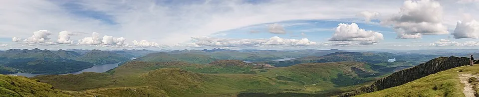
Photo: Podzemnik · CC BY-SA 4.0
Overview

About this Munro

Ben Lomond is a 974m Munro in the Loch Lomond region, its Gaelic name meaning “beacon mountain”. It stands 186th of the 282 Munros by height. The usual ascent — Ben Lomond tourist path from Rowardennan — is a 11.5km round trip taking 5–6.5 hours, rated easy (1/5).

Height rank186th of 282
Coordinates56.1903°N 4.6328°W
OS Grid RefNN 367 028
GPS routes in the appSummit location — full route lines, parking pins & offline maps in the free app.
Plan your day

Routes & Navigation

There is 1 route to the summit of Ben Lomond, covering 11.5km.

Preview — full GPS track in the app

Ben Lomond tourist path from Rowardennan

5–6.5h round trip11.5km distance
18 summits logged in the last 30 days
In the free appExact parking pin · step-by-step directions · offline GPS trackGet the app
Summit forecasttemperature adjusted to 974m

Loading forecast…

Live from the hill

Community conditions

What walkers found up there recently — logged on the summit in the Munros app.

18 reports3 reports0 today
6 days agologged 5:21pmSummit logged
6 days agologged 9:26amSummit logged
7 days agologged 11:37amSummit logged
7+ days ago · typical from 15 reports
Damp underfoot Access open Parking filling up Good visibility A few walkers about
30 days ago7 days agotoday
Underfoot
Dry ×3Damp ×3Wet ×1
Visibility
Excellent ×1Good ×3Fair ×2Poor ×1
Busyness
Quiet ×4Moderate ×4
Access
Open ×6
Parking
Quiet ×3Busy ×3
Underfoot

None logged this week

Visibility

None logged this week

Busyness

None logged this week

Access

None logged this week

Parking

None logged this week

Munros+No reports yet today

The moment a walker logs this Munro today, Munros+ members see it live in the app.

Unlock with Munros+

Log yours in the app · All Munro conditions →

The full guide

Climbing Ben Lomond

Ben Lomond's tourist path from Rowardennan is one of Scotland's most popular Munro routes, with a difficulty rating of…

Ben Lomond's tourist path from Rowardennan is one of Scotland's most popular Munro routes, with a difficulty rating of just 1/5 making it accessible to determined novices. The 11.5km route follows a well-constructed and maintained path that climbs steadily through woodland before emerging onto open hillside. The gradient increases noticeably on the upper slopes, but the path remains clear and well-defined throughout.

The bog level of 2/5 indicates generally good underfoot conditions, with the path engineered to handle heavy traffic and drainage. Ben Lomond's popularity means the route sees constant maintenance, creating one of Scotland's finest mountain highways. Despite the straightforward nature, the 974-meter height gain is substantial, and the 5-6.5 hour time allowance reflects the need for steady pacing and careful descent.

The upper section becomes rockier and more exposed, demanding concentration particularly in poor weather.

Best Time to Climb Ben Lomond

Ben Lomond is climbed year-round, though spring through autumn offers the most pleasant conditions for the 5-6.5 hour…

Ben Lomond is climbed year-round, though spring through autumn offers the most pleasant conditions for the 5-6.5 hour ascent. The mountain's accessibility means it attracts walkers in all seasons, but winter ascents require winter skills as the upper slopes can be icy and the path becomes treacherous. Summer provides the most reliable weather and longest daylight, though the path can be extremely busy at weekends.

The Loch Lomond location experiences high rainfall, being on the edge of Scotland's wetter western climate zone. Mist can descend rapidly, particularly on the upper slopes, turning the straightforward route into a navigation challenge. Early starts are advisable year-round to avoid crowds and ensure adequate daylight for descent. Ben Lomond can experience surprisingly harsh conditions despite its accessibility, with strong winds on the exposed upper mountain.

Weekday ascents offer quieter experiences than summer weekends when the path resembles a busy footpath.

Getting to Ben Lomond

Rowardennan Car Park sits at the end of a minor road on Loch Lomond's eastern shore, providing the starting point for…

Rowardennan Car Park sits at the end of a minor road on Loch Lomond's eastern shore, providing the starting point for the standard tourist path. The car park is large but fills completely on summer weekends, often by 9am. Facilities include toilets and an information board. There's a parking fee, and overstaying allocated time results in significant fines, so plan your timing carefully.

Access is via the B837 from Drymen, approximately 25 miles from Glasgow, making Ben Lomond one of Scotland's most accessible Munros. The lochside road is single-track with passing places for the final section. Public transport options include buses to Drymen from where you can catch connecting services or taxi to Rowardennan, though services are limited.

The area's popularity means facilities are well-developed, but this also means crowds, particularly on good weather weekends. Consider arriving very early or visiting on weekdays to avoid the busiest periods.

Know the mountain

Ben Lomond Summit

Ben Lomond's summit at 974 meters is a rocky pyramid crowned by a substantial cairn and trig point, offering magnificent…

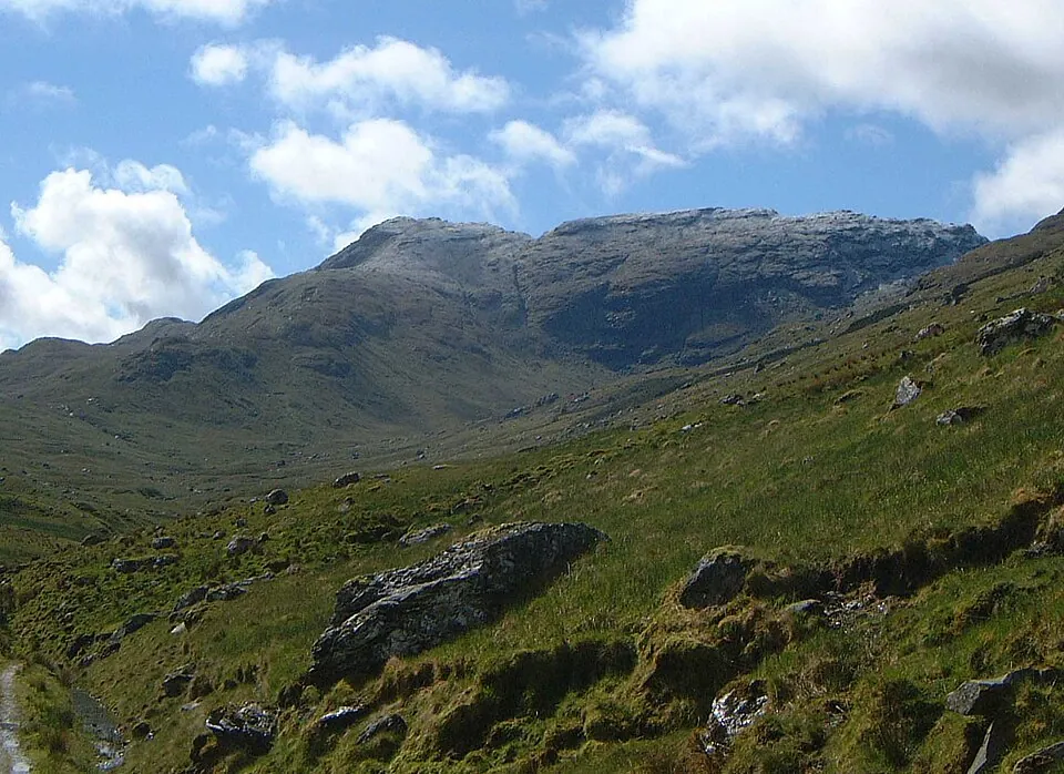
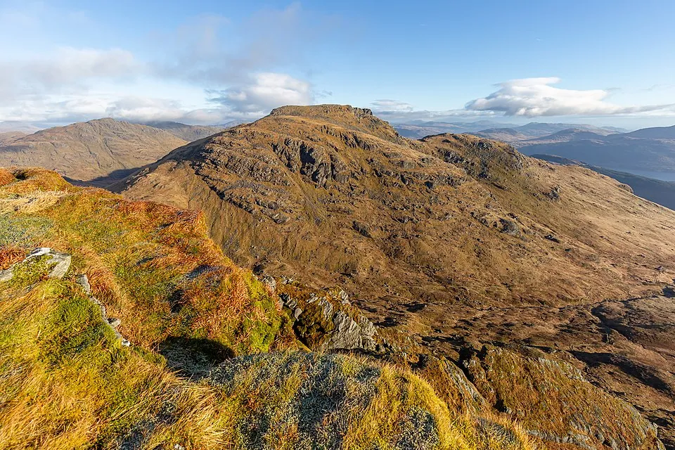
Ben Lomond's summit at 974 meters is a rocky pyramid crowned by a substantial cairn and trig point, offering magnificent views across Loch Lomond and the surrounding landscape. The vista extends west to the Arrochar Alps and north deep into the Highlands, with the loch stretching away below like a map. On clear days, you can see to Glasgow and even glimpse the coast.

The summit is relatively small and can feel crowded on busy days, with limited space around the cairn. Shelter is minimal, and wind can be strong even when conditions are calm at the car park. Ben Lomond's exposed position means weather changes rapidly, with mist rolling in suddenly and obscuring the descent route. The sense of achievement is genuine despite the mountain's accessibility, and the views are truly spectacular.

Don't linger too long if weather deteriorates, as the descent path, though clear, requires concentration and becomes slippery in wet conditions.

Wildlife on Ben Lomond

Ben Lomond's lower slopes feature oak and birch woodland managed by the National Park, providing habitat for woodland…

Ben Lomond's lower slopes feature oak and birch woodland managed by the National Park, providing habitat for woodland birds including woodpeckers and treecreepers. As you climb above the treeline, the landscape opens to heather moorland with scattered rowan and birch. Red deer are frequently spotted, particularly in early morning or evening, and the area supports healthy populations.

The mountain's position on the Highland boundary creates diverse habitats, with the wetter western climate supporting lush vegetation at lower elevations. Higher up, montane heath takes over, with hardy grasses and dwarf shrubs adapted to exposure and altitude. Meadow pipits and skylarks are common in summer, and you might spot buzzards circling on thermals. Mountain hares inhabit the higher slopes, though they're less common than on more remote peaks.

Ben Lomond's accessibility means wildlife can be wary of humans, but patient observation reveals the typical mountain fauna of heather moorland and alpine zones.

Ben Lomond Tips

Despite the 1/5 difficulty rating and excellent path, Ben Lomond requires proper preparation including navigation…

Despite the 1/5 difficulty rating and excellent path, Ben Lomond requires proper preparation including navigation equipment and mountain clothing. The popularity creates a false sense of security, but weather at 974 meters can be severe, and mist can disorient even on this well-trodden route. Carry map and compass and know how to use them, as the summit can be confusing in poor visibility.

Water is available from streams on the ascent, but carry adequate supplies. Mobile phone signal is generally good, benefiting from proximity to population centres, but don't rely on it at altitude. The 2/5 bog rating indicates decent conditions, but waterproof boots remain essential. Ben Lomond's popularity means rescue services are aware of the route, but this shouldn't encourage complacency.

Pack warm layers and full waterproofs, and allow adequate time for descent, which can be tough on knees. The mountain sees numerous callouts for underprepared walkers, so don't become a statistic by underestimating this accessible but genuine mountain.
Keep bagging

Nearby Munros in Loch Lomond

Explore more peaks near Loch Lomond.

Good to know

Frequently Asked Questions

Common questions about climbing Ben Lomond.

How tall is Ben Lomond?

Ben Lomond stands at 974 metres (3,196 feet), making it the 186th tallest of all 282 Munros in Scotland.

What does Ben Lomond mean in Gaelic?

The name Ben Lomond translates from Scottish Gaelic as “Beacon Mountain”.

How long does it take to climb Ben Lomond?

Climbing Ben Lomond typically takes between 5 and 6.5 hours round trip. This varies with fitness, weather, and the route chosen.

Where do I park for Ben Lomond?

There is dedicated parking at the standard starting point for the main route up Ben Lomond, in the Loch Lomond area. The exact car park location, map pin and arrival guidance are in the free Munros app.

How difficult is Ben Lomond to climb?

Ben Lomond is rated Easy (difficulty 1/5).

What is the best route up Ben Lomond?

The most popular route up Ben Lomond covers 11.5km, 5–6.5 hours round trip.

Is Ben Lomond good for beginners?

Ben Lomond is an excellent choice for beginners in the Loch Lomond area. Rated difficulty 1/5 at 974m, it has well-marked paths and straightforward terrain — a great first Munro.

What region is Ben Lomond in?

Ben Lomond is in the Loch Lomond region of Scotland. Nearby Munros include An Caisteal, Beinn a' Chròin, Beinn Chabhair.

Start your journey

Ready to bag
them all?

Track all 282 Munros, plan routes, and log every summit. Join 2,400+ hillwalkers already using Munros.app.

Download for iPhone Free on the App Store