Home Features Explore Munros Munro Map Live Conditions Reviews Get the App

Geal Chàrn (Monadhliath)

917m Cairngorms

“White Cairn”

19.8kmRound trip
5.1–6.6hWalk time
Hard · 4/5Difficulty
Community summits
2Last 30 days
0Last 7 days
0Today
Live
Current conditions
13 days ago
DampUnderfoot
OpenAccess
QuietBusyness
Overview

About this Munro

Geal Chàrn (Monadhliath) is a 917m Munro in the Cairngorms region, its Gaelic name meaning “white cairn”. It stands 278th of the 282 Munros by height. The usual ascent — A' Mharconaich and Geal Chàrn from Drumochter — is a 19.8km round trip taking 5.1–6.6 hours, rated hard (4/5).

Height rank278th of 282
Coordinates57.0576°N 4.3723°W
OS Grid RefNN 562 987
GPS routes in the appSummit location — full route lines, parking pins & offline maps in the free app.
Plan your day

Routes & Navigation

There is 1 route to the summit of Geal Chàrn (Monadhliath), covering 19.8km.

Preview — full GPS track in the app

A' Mharconaich and Geal Chàrn from Drumochter

5.1–6.6h round trip19.8km distance
2 summits logged in the last 30 days
In the free appExact parking pin · step-by-step directions · offline GPS trackGet the app
Summit forecasttemperature adjusted to 917m

Loading forecast…

Live from the hill

Community conditions

What walkers found up there recently — logged on the summit in the Munros app.

2 reports0 reports0 today
7+ days ago · typical from 2 reports
Damp underfoot Access open Excellent visibility Quiet hill
30 days ago7 days agotoday
Underfoot
Damp ×1
Visibility
Excellent ×1
Busyness
Quiet ×1
Access
Open ×1
Parking

No reports yet — be the first to log this

Underfoot

None logged this week

Visibility

None logged this week

Busyness

None logged this week

Access

None logged this week

Parking

None logged this week

Munros+No reports yet today

The moment a walker logs this Munro today, Munros+ members see it live in the app.

Unlock with Munros+

Log yours in the app · All Munro conditions →

The full guide

Climbing Geal Chàrn (Monadhliath)

Geal Chàrn (Monadhliath) offers a different character from many Scottish Munros, lying in the rounded, remote hills east…

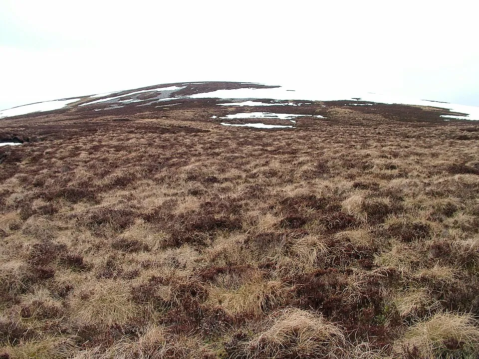
Geal Chàrn (Monadhliath) offers a different character from many Scottish Munros, lying in the rounded, remote hills east of Loch Ness. While the ascent is relatively short compared to many Munros, the route from Balsporran Cottages still covers nearly 20 kilometres when combined with A' Mharconaich as part of the typical traverse. The terrain is characteristically Monadhliath—broad, grassy ridges with extensive peat hags and boggy sections reflecting the 3/5 bog rating.

Path quality is variable, with reasonable stalkers' tracks lower down deteriorating into pathless terrain higher up. Geal Chàrn (Monadhliath) rises to 917 metres, making it one of the lower Munros, yet the featureless nature of the surrounding hills creates navigational challenges disproportionate to the altitude. The gradient is generally moderate rather than steep, with the climb spread over sustained distance.

The difficulty rating of 4/5 reflects the demanding nature of the terrain and navigation rather than technical challenges. This White Cairn (yet another peak with this name) is often climbed as part of a multi-peak circuit from Drumochter, requiring 5-7 hours of walking time.

Best Time to Climb Geal Chàrn (Monadhliath)

The best conditions for climbing Geal Chàrn (Monadhliath) typically occur from late spring through early autumn, with…

The best conditions for climbing Geal Chàrn (Monadhliath) typically occur from late spring through early autumn, with May to September offering the most reliable weather. The Monadhliath range experiences the same rapid weather changes as other Scottish mountains, but the moderate altitude of 917 metres means conditions are often slightly less severe than on higher peaks.

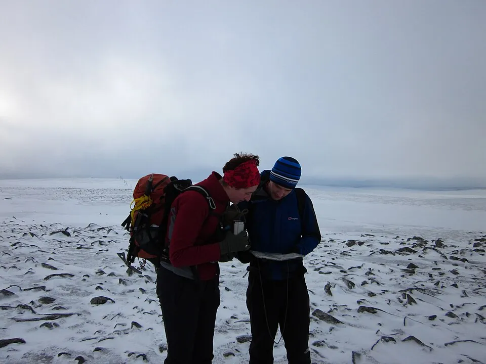
Summer provides long daylight hours useful for completing the multi-peak circuit that typically includes Geal Chàrn (Monadhliath). The broad, featureless terrain becomes particularly challenging in poor visibility, so target clear weather windows when possible. Winter transforms this rounded summit into a serious navigation challenge, with whiteout conditions easily occurring and the pathless terrain difficult to navigate when snow-covered.

The eastern location means Geal Chàrn (Monadhliath) receives somewhat less precipitation than western peaks, benefiting from a rain shadow effect, though you should never underestimate Highland weather. Spring and autumn can offer excellent visibility with dramatic lighting across the empty Monadhliath landscape. The moderate altitude means snow doesn't linger as long as on higher peaks, extending the non-winter season slightly at either end.

Getting to Geal Chàrn (Monadhliath)

Access to Geal Chàrn (Monadhliath) typically begins at Balsporran Cottages near Drumochter Pass on the A9. This remote…

Access to Geal Chàrn (Monadhliath) typically begins at Balsporran Cottages near Drumochter Pass on the A9. This remote parking area is reached via a short track off the main road, with limited space for vehicles. The high-altitude start at Drumochter means you're already at around 450 metres, reducing the overall ascent required to reach Geal Chàrn (Monadhliath). From the parking area, the route heads east across open moorland toward the broad ridges of the Monadhliath.

The A9 provides excellent year-round access, though winter conditions on this exposed section of road can be severe. Balsporran Cottages offers no facilities beyond parking, so come fully prepared. The nearest services are in Dalwhinnie a few kilometres north or Newtonmore further down the A9. Mobile signal at the start is generally good given the proximity to the main road, but disappears quickly once you head into the empty Monadhliath hills.

The remoteness and featureless nature of the terrain approaching Geal Chàrn (Monadhliath) means thorough preparation is essential before leaving your vehicle. The parking area also serves routes to other Drumochter peaks, so arrive early during summer weekends.

Know the mountain

Geal Chàrn (Monadhliath) Summit

The summit of Geal Chàrn (Monadhliath) at 917 metres exemplifies the rounded, gentle character of this mountain range.…

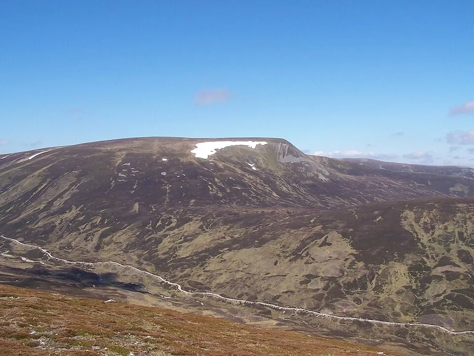
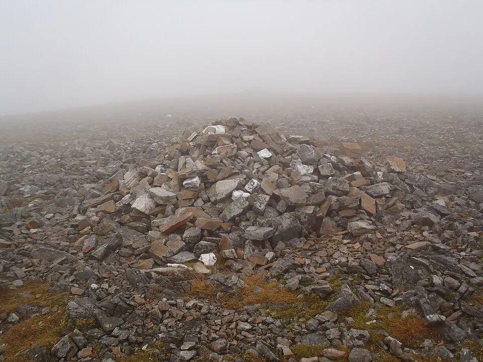
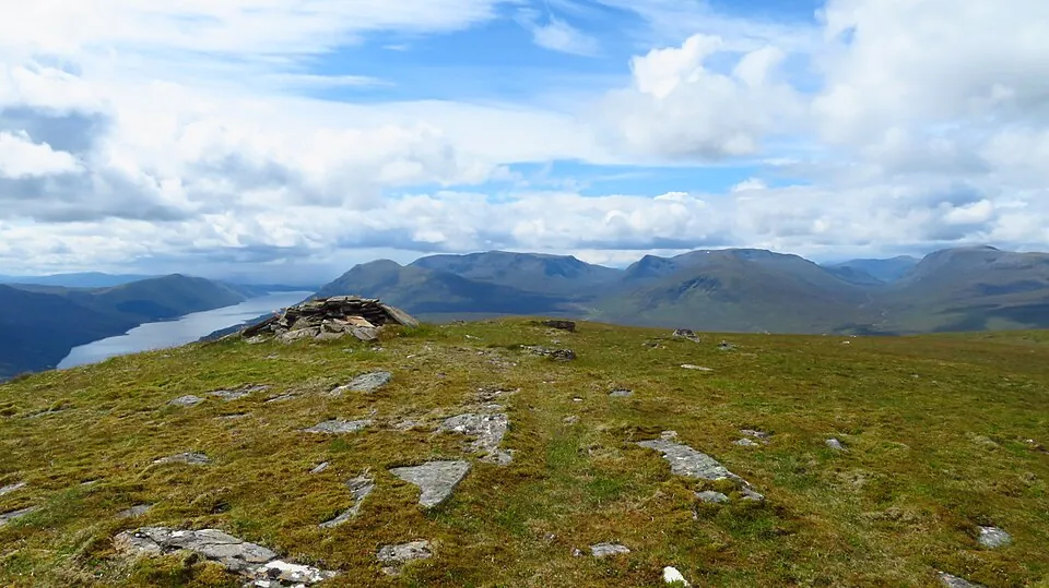
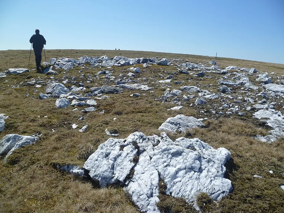
The summit of Geal Chàrn (Monadhliath) at 917 metres exemplifies the rounded, gentle character of this mountain range. You'll stand on a broad, grassy dome marked by a cairn, with the sense of space and openness profound. The White Cairn lives up to its name with pale rocks scattered around the summit area. Views extend across the rolling Monadhliath hills, which stretch away like waves on an ocean—ridge after rounded ridge disappearing into the distance.

To the west, the more dramatic peaks around the A9 corridor contrast sharply with the softer terrain of Geal Chàrn (Monadhliath). The summit area is featureless and requires careful navigation, particularly in mist when the gentle slopes and lack of distinct features make route-finding challenging. Despite the modest altitude, the summit delivers a genuine mountain experience with extensive panoramas on clear days.

There's limited shelter from wind given the exposed, rounded nature of Geal Chàrn (Monadhliath)—the broad summit offers nowhere to hide when conditions are poor. The remoteness creates a special atmosphere—these empty hills see far fewer visitors than more dramatic ranges.

Wildlife on Geal Chàrn (Monadhliath)

The Monadhliath hills surrounding Geal Chàrn offer classic Highland moorland habitat dominated by heather, peat bogs,…

The Monadhliath hills surrounding Geal Chàrn offer classic Highland moorland habitat dominated by heather, peat bogs, and rough grassland. This is prime red deer country, and you'll very likely encounter herds during your approach—the open terrain means you can often spot them from considerable distance. The extensive peat bogs support rich communities of sphagnum moss, cotton grass, and bog asphodel, creating colourful patterns across the waterlogged ground.

Heather dominates drier slopes, blooming purple in late summer to create stunning displays. As you climb Geal Chàrn (Monadhliath), vegetation becomes sparser, with montane grasses and dwarf shrubs increasingly prominent. Red grouse burst from the heather with explosive alarm calls—these gamebirds are abundant across the Monadhliath moors. Watch for raptors including hen harriers quartering low over the moorland, and golden eagles soaring on thermals above the ridges.

Mountain hares inhabit the higher ground, their coats turning white for winter. The modest altitude of Geal Chàrn (Monadhliath) means true arctic-alpine species are absent, but the moorland ecology is rich and typical of the eastern Highlands. The relatively dry climate compared to western ranges influences vegetation patterns noticeably.
Geal Chàrn (Monadhliath) Tips

Navigation is the primary challenge when climbing Geal Chàrn (Monadhliath), as the featureless terrain becomes extremely…

Navigation is the primary challenge when climbing Geal Chàrn (Monadhliath), as the featureless terrain becomes extremely difficult in poor visibility. Carry map, compass, and GPS device, and ensure you're confident navigating across broad, gentle slopes where landmarks are scarce. The bog level of 3/5 means progress can be slower than the distance suggests, particularly after wet weather when the peat hags become more challenging.

The route typically covers nearly 20 kilometres when including A' Mharconaich, requiring 5-7 hours, so pack adequate food and water. Mobile signal disappears quickly once you leave the A9 corridor, so ensure your emergency plans are solid before setting out for Geal Chàrn (Monadhliath). Despite the modest altitude of 917 metres, weather can still deteriorate rapidly, and the featureless terrain makes retreat challenging in poor visibility.

Start with a clear weather forecast and be prepared to turn back if cloud descends. The difficulty rating of 4/5 reflects navigational challenges rather than technical climbing—don't be misled by the moderate altitude. Carry full hillwalking kit including waterproofs and warm layers. The exposed nature of Geal Chàrn (Monadhliath) means you'll feel the full force of any wind, so check forecasts carefully before committing to this remote peak.

Good to know

Frequently Asked Questions

Common questions about climbing Geal Chàrn (Monadhliath).

How tall is Geal Chàrn (Monadhliath)?

Geal Chàrn (Monadhliath) stands at 917 metres (3,009 feet), making it the 278th tallest of all 282 Munros in Scotland.

What does Geal Chàrn (Monadhliath) mean in Gaelic?

The name Geal Chàrn (Monadhliath) translates from Scottish Gaelic as “White Cairn”.

How long does it take to climb Geal Chàrn (Monadhliath)?

Climbing Geal Chàrn (Monadhliath) typically takes between 5.1 and 6.6 hours round trip. This varies with fitness, weather, and the route chosen.

Where do I park for Geal Chàrn (Monadhliath)?

There is dedicated parking at the standard starting point for the main route up Geal Chàrn (Monadhliath), in the Cairngorms area. The exact car park location, map pin and arrival guidance are in the free Munros app.

How difficult is Geal Chàrn (Monadhliath) to climb?

Geal Chàrn (Monadhliath) is rated Hard (difficulty 4/5). In practice that means long, steep, rough ground where confident footwork and navigation matter.

What is the best route up Geal Chàrn (Monadhliath)?

The most popular route up Geal Chàrn (Monadhliath) covers 19.8km, 5.1–6.6 hours round trip.

Is Geal Chàrn (Monadhliath) good for beginners?

No — Geal Chàrn (Monadhliath) (difficulty 4/5 at 917m) is best suited to experienced hillwalkers in the Cairngorms area. Expect sustained steep terrain and the need for confident navigation in poor visibility.

What region is Geal Chàrn (Monadhliath) in?

Geal Chàrn (Monadhliath) is in the Cairngorms region of Scotland. Nearby Munros include A' Bhuidheanach Bheag, A' Chailleach (Monadhliath), A' Mharconaich.

Start your journey

Ready to bag
them all?

Track all 282 Munros, plan routes, and log every summit. Join 2,400+ hillwalkers already using Munros.app.

Download for iPhone Free on the App Store