Home Features Explore Munros Munro Map Live Conditions Reviews Get the App
Geal-chàrn (Drumochter), Cairngorms, Scotland

Geal-chàrn (Drumochter)

917m Cairngorms

“White Cairn”

19.8kmRound trip
5.1–6.6hWalk time
Moderate · 2/5Difficulty
Community summits
6Last 30 days
1Last 7 days
0Today
Live
Current conditions
13 days ago
DampUnderfoot
OpenAccess
QuietBusyness
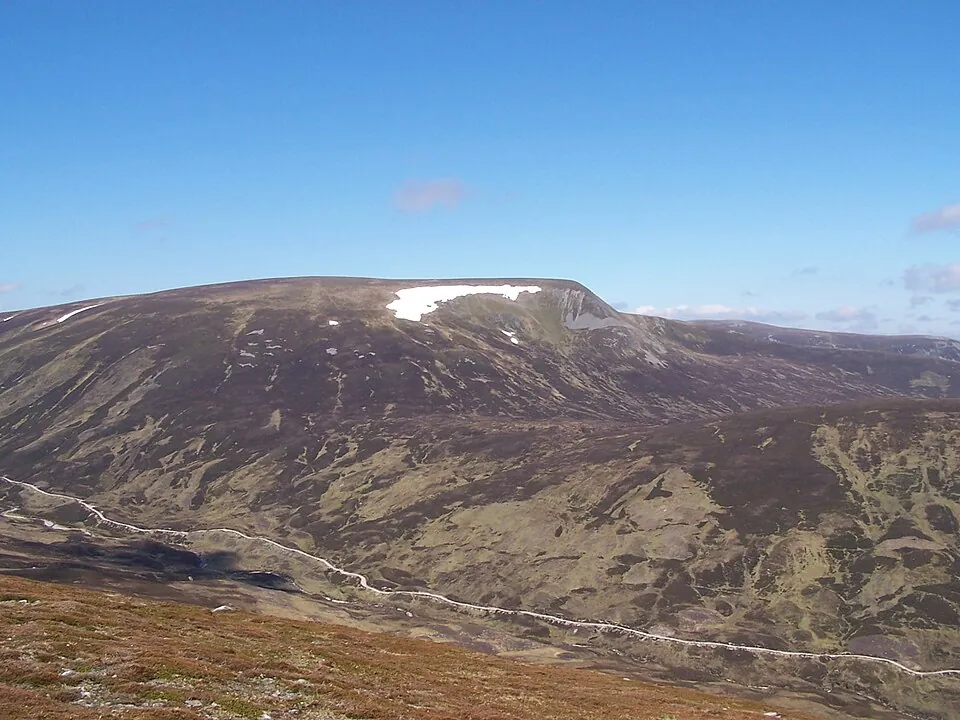
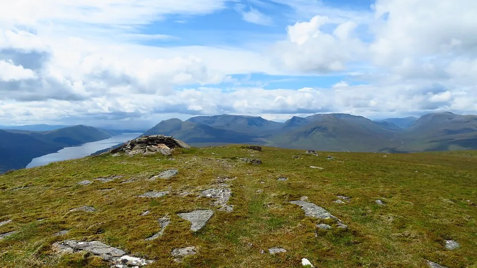
Photo: GeographBot · CC BY-SA 2.0
Overview

About this Munro

Geal-chàrn (Drumochter) is a 917m Munro in the Cairngorms region, its Gaelic name meaning “white cairn”. It stands 279th of the 282 Munros by height. The usual ascent — Geal Chàrn (Drumochter) and A' Mharconaich from Drumochter — is a 19.8km round trip taking 5.1–6.6 hours, rated moderate (2/5).

Height rank279th of 282
Coordinates56.8746°N 4.3032°W
OS Grid RefNN 597 782
GPS routes in the appSummit location — full route lines, parking pins & offline maps in the free app.
Plan your day

Routes & Navigation

There are 2 routes to the summit of Geal-chàrn (Drumochter), ranging from 19.8km.

Preview — full GPS track in the app

Geal Chàrn (Drumochter) and A' Mharconaich from Drumochter

Bags 2 MunrosA' MharconaichGeal-chàrn (Drumochter)
5.1–6.6h round trip19.8km distance
6 summits logged in the last 30 days
In the free appExact parking pin · step-by-step directions · offline GPS trackGet the app
Preview — full GPS track in the app

A' Mharconaich and Geal Chàrn from Drumochter

5.1–6.6h round trip19.8km distance
6 summits logged in the last 30 days
In the free appExact parking pin · step-by-step directions · offline GPS trackGet the app
Summit forecasttemperature adjusted to 917m

Loading forecast…

Live from the hill

Community conditions

What walkers found up there recently — logged on the summit in the Munros app.

6 reports1 report0 today
4 days agologged 10:53pmSummit logged
7+ days ago · typical from 5 reports
Damp underfoot Access open Parking filling up Excellent visibility Quiet hill
30 days ago7 days agotoday
Underfoot
Damp ×1Boggy ×1
Visibility
Excellent ×2
Busyness
Quiet ×2
Access
Open ×2
Parking
Busy ×1
Underfoot

None logged this week

Visibility

None logged this week

Busyness

None logged this week

Access

None logged this week

Parking

None logged this week

Munros+No reports yet today

The moment a walker logs this Munro today, Munros+ members see it live in the app.

Unlock with Munros+

Log yours in the app · All Munro conditions →

The full guide

Climbing Geal-chàrn (Drumochter)

The ascent of Geal-chàrn (Drumochter) presents a relatively straightforward but lengthy walk across the broad, rolling…

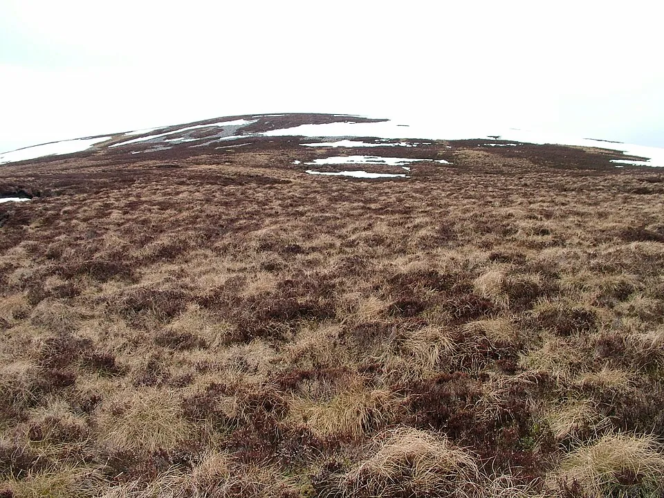
The ascent of Geal-chàrn (Drumochter) presents a relatively straightforward but lengthy walk across the broad, rolling plateaux characteristic of the Drumochter Hills. Starting from Balsporran or Balsporran Cottages, you'll tackle a 19.8km route that's often combined with A' Mharconaich. The terrain underfoot can be boggy in places, particularly across the intermediate moorland sections, so gaiters are a wise choice.

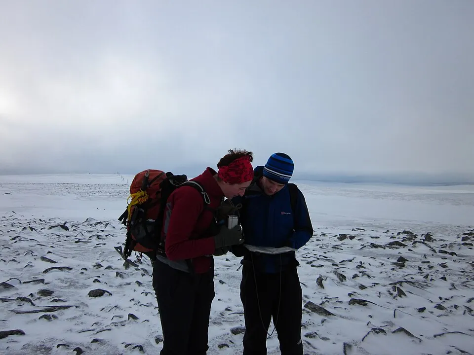
The paths are generally well-worn but become fainter as you gain height onto the whale-backed summit ridge. Gradients are mostly gentle and steady rather than steep, though the sheer distance can test your stamina. Geal-chàrn (Drumochter) rewards patience rather than athleticism, with long approaches that feel remote despite the proximity of the A9. The complexity lies not in technicality but in navigating featureless terrain when cloud descends on this exposed mountain.

Best Time to Climb Geal-chàrn (Drumochter)

Geal-chàrn (Drumochter) is best tackled between late spring and early autumn when daylight hours are generous for the…

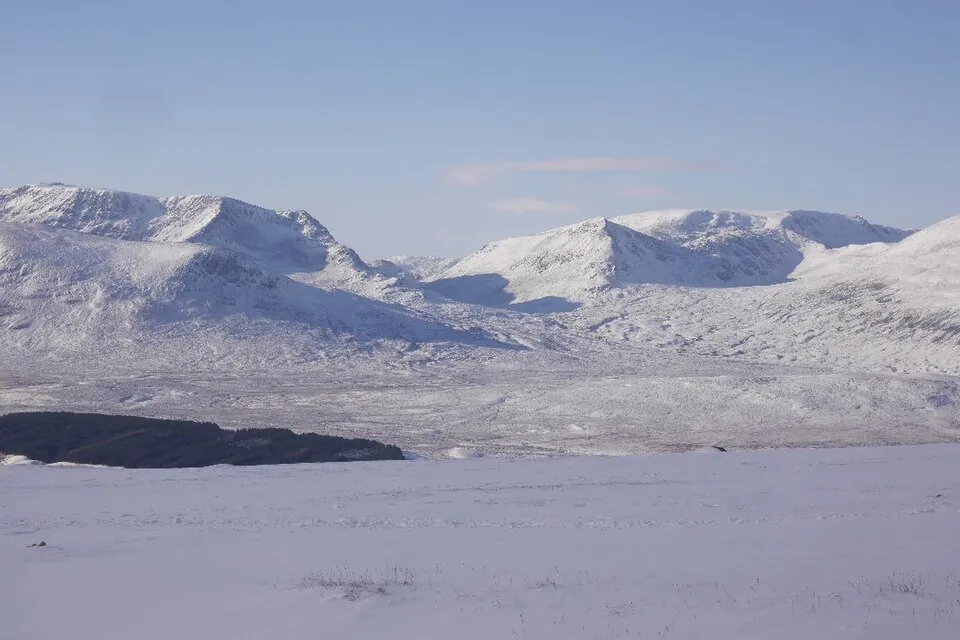
Geal-chàrn (Drumochter) is best tackled between late spring and early autumn when daylight hours are generous for the long approach. Winter ascents are certainly possible, but the exposed nature of the Drumochter plateau means you'll face bitter winds and rapid weather changes. Snow can linger well into May at this altitude, transforming gentle slopes into more serious winter terrain requiring crampons and ice axe.

Summer offers the longest days and most stable conditions, though midges can be troublesome in July and August in the lower glens. Autumn brings spectacular colours to the moorland but shorter days, so an early start is essential for this distance. The Cairngorms region is drier than the west coast but still sees plenty of precipitation, and Geal-chàrn (Drumochter) sits fully exposed to weather systems tracking across the high ground.

Getting to Geal-chàrn (Drumochter)

Access to Geal-chàrn (Drumochter) begins from the Balsporran area along the A9 between Dalwhinnie and Blair Atholl.…

Access to Geal-chàrn (Drumochter) begins from the Balsporran area along the A9 between Dalwhinnie and Blair Atholl. Parking is available at Balsporran or Balsporran Cottages, though spaces can be limited during busy periods. The location is convenient, lying right alongside Scotland's main arterial route through the central Highlands, making it easily accessible from Perth to the south or Inverness to the north.

The approach track is clear initially, following old drove roads through the glen before striking out onto the open hillside. While the A9 provides straightforward access, be aware that the parking areas serve multiple routes in the Drumochter group, so arrive early on summer weekends. The remoteness of Geal-chàrn (Drumochter) means once you leave the roadside, you're committed to a long day with limited bail-out options until you return the way you came.

Know the mountain

Geal-chàrn (Drumochter) Summit

The summit of Geal-chàrn (Drumochter) sits at 917 metres, marked by a modest cairn atop a broad, gently rounded plateau.…

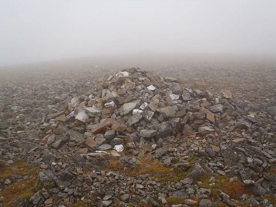
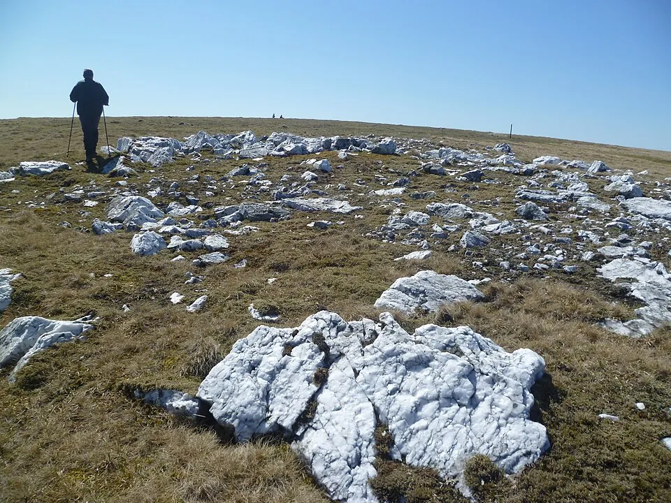
The summit of Geal-chàrn (Drumochter) sits at 917 metres, marked by a modest cairn atop a broad, gently rounded plateau. The name White Cairn speaks to the pale quartzite rocks scattered across this exposed crown, which catch the light beautifully on clear days. Views extend across the entire Drumochter range, with the Cairngorms massif dominating the eastern and northern horizons. On exceptionally clear days, you might trace the outline of Ben Nevis far to the west.

The summit offers little shelter from the wind, which can howl across this featureless expanse even on otherwise pleasant days. There's a stark, minimalist beauty to standing atop Geal-chàrn (Drumochter), surrounded by rolling moorland in every direction. The summit plateau is wide and gently contoured, making it surprisingly easy to wander off-route in poor visibility, so careful navigation is essential despite the mountain's modest technical difficulty.

Wildlife on Geal-chàrn (Drumochter)

The lower approaches to Geal-chàrn (Drumochter) traverse classic Highland moorland dominated by heather, cotton grass,…

The lower approaches to Geal-chàrn (Drumochter) traverse classic Highland moorland dominated by heather, cotton grass, and sphagnum moss, creating a spongy, waterlogged habitat that supports distinctive wildlife. Red deer are common throughout the Drumochter Hills, often seen grazing the slopes or silhouetted on ridgelines.

As you climb Geal-chàrn (Drumochter), the vegetation transitions to hardier montane heath communities of bilberry, crowberry, and dwarf shrubs adapted to exposure and thin soils. Mountain hares, in their white winter coats or mottled summer pelage, inhabit these higher zones. Golden eagles patrol the skies, and you may spot ptarmigan on the summit plateau, particularly above 900 metres where these Arctic specialists thrive.

The Cairngorms region is relatively dry compared to western ranges, so the vegetation here is less lush but no less fascinating, with alpine wildflowers like moss campion clinging to rocky outcrops.
Geal-chàrn (Drumochter) Tips

Navigation skills are absolutely critical on Geal-chàrn (Drumochter), as the broad, featureless terrain becomes…

Navigation skills are absolutely critical on Geal-chàrn (Drumochter), as the broad, featureless terrain becomes dangerously disorienting in mist or snow. Carry a map, compass, and ideally a GPS device, and know how to use them confidently. The long distances involved mean you should pack sufficient food and water for a full day, as there are no reliable water sources once you leave the lower glens.

Mobile phone signal is patchy to non-existent across much of the route, so don't rely on technology for emergencies. Weather on Geal-chàrn (Drumochter) can deteriorate rapidly, with the exposed plateau funnelling winds to considerable strength. Even in summer, pack warm and waterproof layers. The boggy ground conditions mean proper waterproof boots are essential, not optional.

Tell someone your route and expected return time before setting out, as this is remote country where self-reliance is paramount.

Good to know

Frequently Asked Questions

Common questions about climbing Geal-chàrn (Drumochter).

How tall is Geal-chàrn (Drumochter)?

Geal-chàrn (Drumochter) stands at 917 metres (3,009 feet), making it the 279th tallest of all 282 Munros in Scotland.

What does Geal-chàrn (Drumochter) mean in Gaelic?

The name Geal-chàrn (Drumochter) translates from Scottish Gaelic as “White Cairn”.

How long does it take to climb Geal-chàrn (Drumochter)?

Climbing Geal-chàrn (Drumochter) typically takes between 5.1 and 6.6 hours round trip. This varies with fitness, weather, and the route chosen — there are 2 routes to the summit.

Where do I park for Geal-chàrn (Drumochter)?

There is dedicated parking at the standard starting point for the main route up Geal-chàrn (Drumochter), in the Cairngorms area. The exact car park location, map pin and arrival guidance are in the free Munros app.

How difficult is Geal-chàrn (Drumochter) to climb?

It depends on the route: the easiest way up Geal-chàrn (Drumochter) is rated Moderate (difficulty 2/5), while A' Mharconaich and Geal Chàrn from Drumochter is Hard (4/5).

What is the best route up Geal-chàrn (Drumochter)?

The most popular route up Geal-chàrn (Drumochter) covers 19.8km, 5.1–6.6 hours round trip. There are 2 routes to the summit in total, ranging from Moderate to Hard difficulty.

Is Geal-chàrn (Drumochter) good for beginners?

Geal-chàrn (Drumochter) in the Cairngorms area is well suited to walkers with some hillwalking experience. Rated difficulty 2/5 at 917m via its easiest route, the paths are clear and the terrain is not technically demanding.

What region is Geal-chàrn (Drumochter) in?

Geal-chàrn (Drumochter) is in the Cairngorms region of Scotland. Nearby Munros include A' Bhuidheanach Bheag, A' Chailleach (Monadhliath), A' Mharconaich.

Start your journey

Ready to bag
them all?

Track all 282 Munros, plan routes, and log every summit. Join 2,400+ hillwalkers already using Munros.app.

Download for iPhone Free on the App Store